Decision support for territorial energy planning
— At the time of the energy transition, local decision-makers are confronted with new issues of territorial planning, the energy dimension becoming a key factor in decision-making.
Acting on energy consumption, reducing CO2 emissions, ensuring a coordinated development of distribution networks, enhancing the potential of local renewable production, are all challenges to be met in a context of increasing decentralization.


supporting territories in the energy transition
— With the help of Artelys Crystal City, Grenoble Alpes Métropole was able to analyze the impact of action scenarios and bring out a concrete and concerted plan to reach ambitious goals by 2030.
%
Greenhouse gas
%
Nitrogen oxides
%
Particles
%
Renewable and recovery energy
%
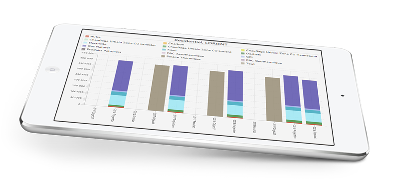
Energy consumption
a proven methodology
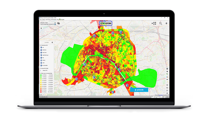
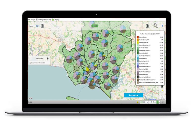
— Analysis of the territorial energy system
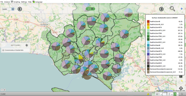
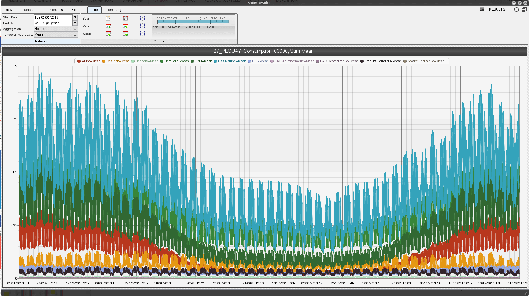
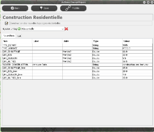
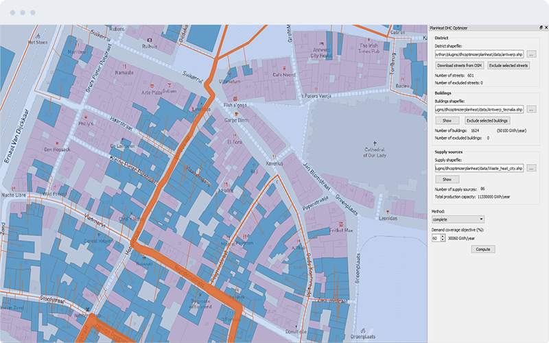
Modeling energy data of the territory
Ergonomic data mining features in Cartographic & Graphical format
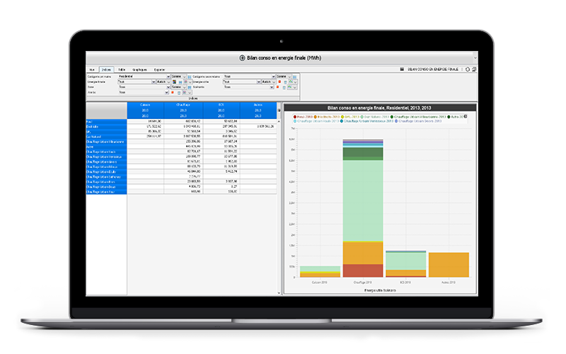
Calculation of parameterizable indicators allowing the analysis of the energy options of the territory
![]() Support to the consultation
Support to the consultation
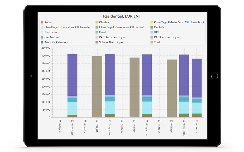
— Simulation of action scenarios
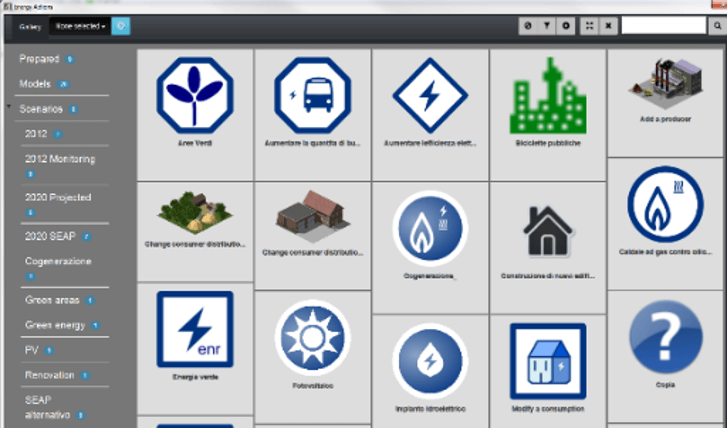
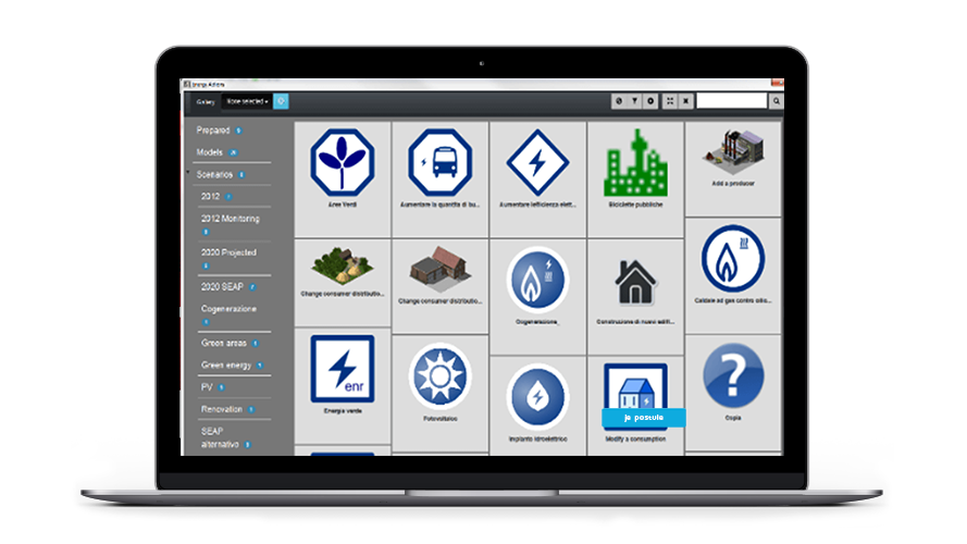
Definition of scenarios based on the combination of easily parameterizable unit actions
Multi-scenario management system
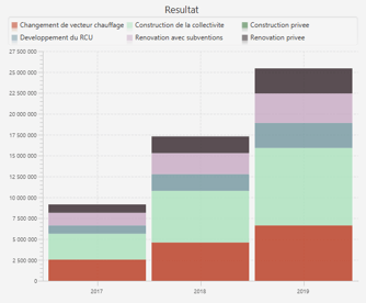
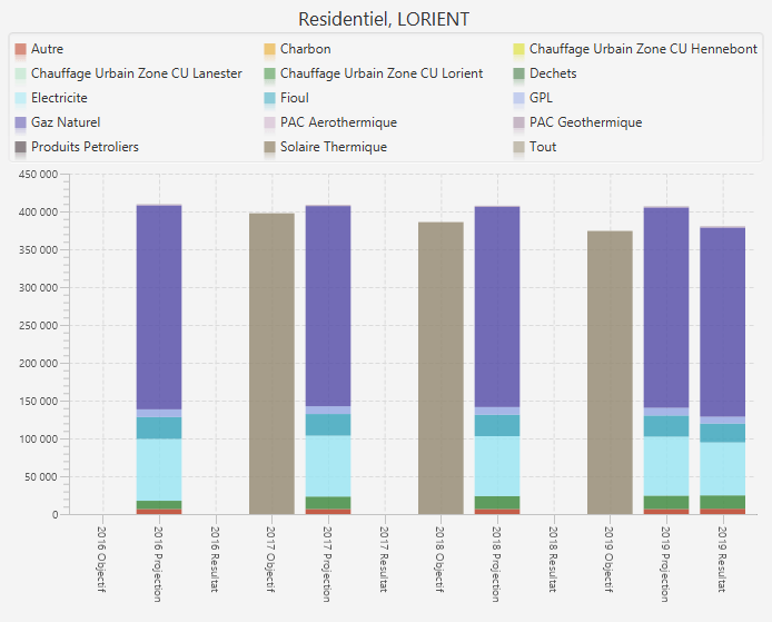
Techno-economic simulation of system operation and recalculation of evaluation indicators
— Track, drive,
coordinate
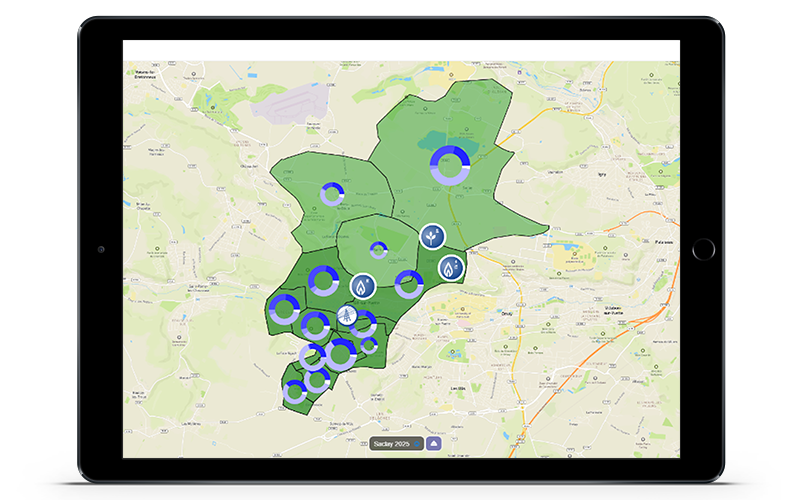
Follow the evaluation of the territory after the implementation of the actions
System for updating the data measured on the territory
![]() Tracking of PCAET actions
Tracking of PCAET actions
powerful features
why Artelys Crystal City?
Multi-energy
Model competitions and complementarities between energies
Hourly time step
Evaluate flexibility solutions: smart grids, electric vehicles, intermittent renewable generation, storage, etc.
Evaluate the energy balance of the territory and its networks
Useful energy
The energy chain based on a model of useful energy consumption, allows to act directly on consumer uses
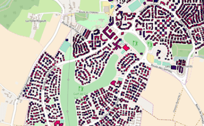
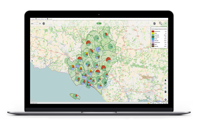
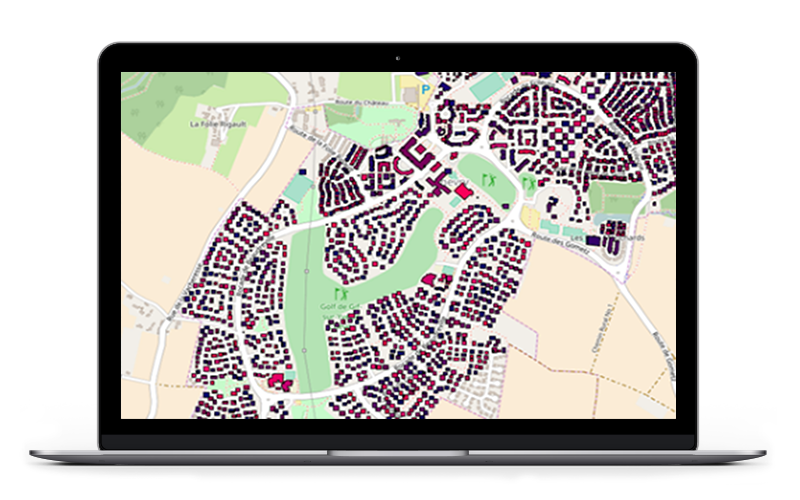
Cadastral mesh
Work on a geographic grid that is fine enough to be able to analyze the acts and their impacts at the scale of the territory
Decision support
Build territorial energy scenarios, to be evaluated according to techno-economic and environmental criteria
undeniable successes
![]()
Since 2014, Artelys has supported the energy mission of the Métropole de Lyon on the creation and parameterization of a modeling tool for its energy system, in order to develop its Energy Master Plan.
![]()
Thanks to a powerful energy modeling and results from the Artelys Crystal City software, the Métropole de Grenoble published, in 2016, an ambitious Energy Master Plan by 2030.
![]()
The community of communes of the Pays de Gex has acquired Artelys Crystal City in 2017, becoming the first French community to take advantage of the opportunities offered by the energy transition law for green growth to have an energy model of its own territory with the cadastral mesh.
many references


download the brochure
testimony
— “Artelys has supported us throughout the development of our Energy Master Plan, which defines the metropolitan energy strategy by 2030. The Artelys Crystal City software allowed us to evaluate the impact of energy actions envisaged and guide our choices in the construction of the selected scenario.”
Request demo
© ARTELYS • All rights reserved • Legal mentions